Land risk report tool
Know your land before you build on it.
Geo Prithvi Report is a land risk report tool. Drop a pin anywhere in the world and it checks flood history, earthquake exposure, terrain, heat and cold, and legal flags, then gives you a PDF to share with your engineer, partner or family before you buy or build.
From pin to PDF in four steps
No field visit and no paperwork to start. You choose the location and the plan, the report is built for you.
Place a pin
Search an address or place name, or tap the map. Coordinates work too.
Choose a project type
Home, farm, factory, solar, commercial or school. Recommendations follow your choice.
Pick a plan and pay
Basic, Standard or Premium. Payment is handled securely by Razorpay.
Download the report
Your PDF is generated in the browser and includes sources and a disclaimer.
A clean, printable PDF
White pages, plain layout, and colour only where it signals risk. Easy to read on screen and easy to print.
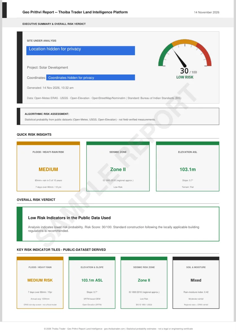 Basic Report3 pagesDownload sample PDF
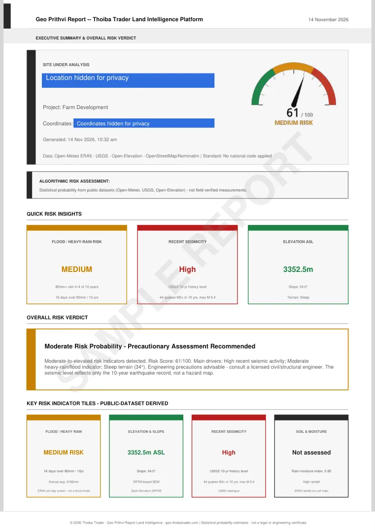 Standard Report5 pagesDownload sample PDF
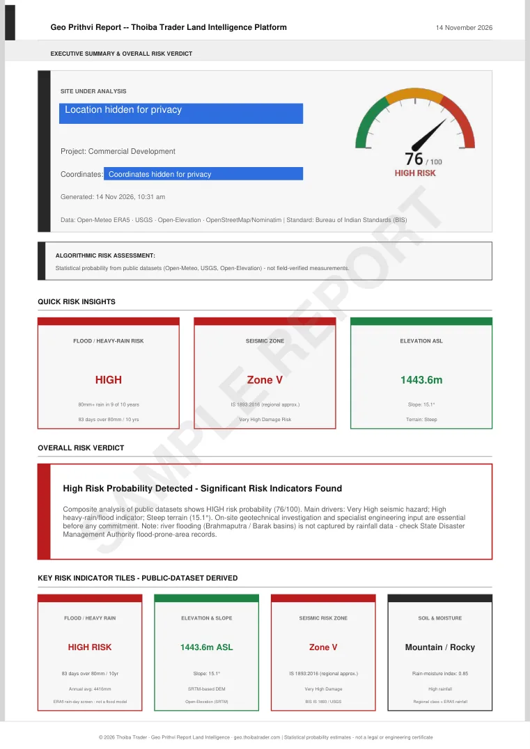 Premium Report8 pagesDownload sample PDF
Real sample reports with the site location and coordinates hidden. Click a page to download the full PDF.
What each report covers
Every plan includes the core hazard checks. Higher plans add depth, history and planning detail.
Flood and rainfall
Flood level worked out from the rainfall record for your pin.
Earthquake exposure
Seismic level and the strongest recent events nearby, with distance from the site.
Elevation and terrain
Height above sea level and slope, which decide drainage and foundation choices.
Heat and cold
Temperature extremes that matter for people, crops and building materials.
Legal flags
Items worth verifying before you buy or build. Available from Standard.
Data confidence
A plain statement of how much to rely on each finding for this location.
Which plan includes what
| Section | Basic | Standard | Premium |
|---|---|---|---|
| Executive summary and risk scoreOverall verdict, score out of 100, key findings. | Yes | Yes | Yes |
| Flood and rainfallFlood level from rainfall history for the pin. | Yes | Yes | Yes |
| Earthquake exposureSeismic level and the strongest recent events nearby, with distance. | Yes | Yes | Yes |
| Elevation and terrainHeight above sea level and slope. | Yes | Yes | Yes |
| Heat and cold stressTemperature extremes relevant to people and materials. | Yes | Yes | Yes |
| Data confidenceHow much to trust each finding for this location. | Yes | Yes | Yes |
| 10-year rainfall and earthquake analysisTrends and event history. | No | Yes | Yes |
| Site conditions and legal flagsItems to verify before buying or building. | No | Yes | Yes |
| Land use and air qualitySurroundings and air quality indication (proxy-based). | No | No | Yes |
| Decadal comparisonEarlier decade against the most recent one. | No | No | Yes |
| Soil moisture and 5-year projectionSeasonal profile and a trend-based outlook. | No | No | Yes |
| Full recommendations, warnings and glossaryDetailed guidance for your project type. | No | No | Yes |
Basic includes 3 recommendations and a 4-item checklist. Standard and Premium add more. Every plan includes data sources and a disclaimer.
Written for your kind of project
The hazard data is the same. The recommendations and checklists change with what you plan to do on the land.
Home or residential plot
Flood, earthquake and slope checks before you buy or start building.
Farm and agriculture
Rainfall pattern, waterlogging exposure and soil moisture for farmland.
Factory or industrial
Hazard exposure and site conditions for plants and warehouses.
Commercial or retail
Drainage, ground and seismic considerations for commercial buildings.
Solar plant
Wind, heat and flood exposure to check before you commit to a site.
School or institution
Life-safety focused findings for buildings used by many people.
Works in India and abroad
Geo Prithvi Report picks the country from your pin. It never applies one country's building code to another.
- India. Seismic zone and structural language follow IS 1893 and related Indian standards.
- Selected countries. The report uses that region's own standard, such as IBC and ASCE 7 in the US, Eurocode in Europe, or AS/NZS in Australia and New Zealand, and names it on the first page.
- Everywhere else. The report states that no national code was applied. Earthquake level is based on recorded events within 100 km over 10 years rather than a code zone.
Pricing
Pay once per report. Prices include 18% GST, and you get a GST invoice.
- Executive summary and risk score
- Flood, earthquake and elevation
- Top 3 recent earthquakes
- Heat and cold stress
- Data confidence
- 3 recommendations, 4-item checklist
- Data sources and disclaimer
- Everything in Basic, plus:
- 10-year rainfall and earthquake analysis
- Site conditions
- Legal flags to verify
- Extended recommendations and checklist
- Everything in Standard, plus:
- Climate-based indications
- Air quality note
- Decadal comparison
- Monthly rainfall and 5-year trend
- Full recommendations, warnings, glossary
Where the data comes from
Reports are built from public datasets, and each report lists its sources.
- Open-MeteoClimate and rainfall history (ERA5 reanalysis).
- USGS earthquake catalogRecorded earthquakes near the site.
- Open-ElevationElevation and terrain.
- OpenStreetMapPlace names and addresses (Nominatim) and nearby map features.
Why the methodology is public. Reports can contain errors, and we cannot promise they never will. That is why every formula, data source and limit is published on the methodology page. Your engineer or consultant can check each number against it, spot anything that looks wrong, and tell us so we can fix it.
Independent product. Geo Prithvi Report is made by Thoiba Trader. It is not affiliated with, sponsored by or endorsed by NASA, USGS, ESA, ECMWF, Open-Meteo, OpenStreetMap or any other data provider named here. Names are used only to credit the public data we use.
Questions
What is Geo Prithvi Report?
Geo Prithvi Report is a land risk report tool by Thoiba Trader. You drop a pin on a map, choose a plan, and receive a PDF covering flood, earthquake, terrain, heat and cold, legal flags and data confidence for that location.
What is the difference between the three plans?
Basic (Rs 299) is a 3-page summary. Standard (Rs 799) is 5 pages and adds a 10-year rainfall and earthquake analysis, site conditions and legal flags. Premium (Rs 1499) is 8 pages and adds climate-based indications, an air-quality note, a decadal comparison, a monthly rainfall profile with a 5-year trend, and the full recommendations and glossary.
Who is Geo Prithvi Report for?
Plot buyers, farmers, developers, investors and engineers who want a quick, data-backed view of a site before they commit money or commission a full survey.
Is this a substitute for a geotechnical survey?
No. A Geo Prithvi Report is a statistical, desk-based assessment from public datasets. Use it to shortlist sites and to prepare questions. A licensed engineer must still be consulted before significant construction.
Which countries does it cover?
Any location. India uses IS 1893 and related standards. Selected countries use their own standard, and the report names it. Elsewhere the report says no national code was applied.
How accurate is the data?
It depends on the source and the location. Climate data is gridded, so it describes the area rather than a single point. Each report includes a data confidence section that shows how much to rely on each finding.
Can I submit the report to a bank or for RERA registration?
No. Geo Prithvi Reports are not legal or engineering certificates. For formal filings you need a report from a licensed engineer or an approved agency.
Is Geo Prithvi Report connected to NASA or other agencies?
No. Geo Prithvi Report is an independent product. It uses publicly available data and is not affiliated with or endorsed by any agency or provider it credits.
Check a plot before you commit to it.
Place a pin, pick a plan, and download your report.
Start analysis